Sunday, 25 October 2009


Walk 13

41. Nab Scar LDW-193 (1476')
42. Heron Pike LDW-128 (2008')
43. Great Rigg LDW-054 (2513')
44. Stone Arthur LDW-175 (1640')

Phil & Judy walked 9.4 miles with 3080 ft ascent

 
Our final day of this long weekend in Keswick and once again we put our faith in several weather forecasts including the MWIS and the BBC. They predicted that we would have some showers and winds of up to 25 mph. So we went for it and ended up regretting it big style, but by then we were too advanced on the ridge path between Nab Scar and Heron Pike to turn back.
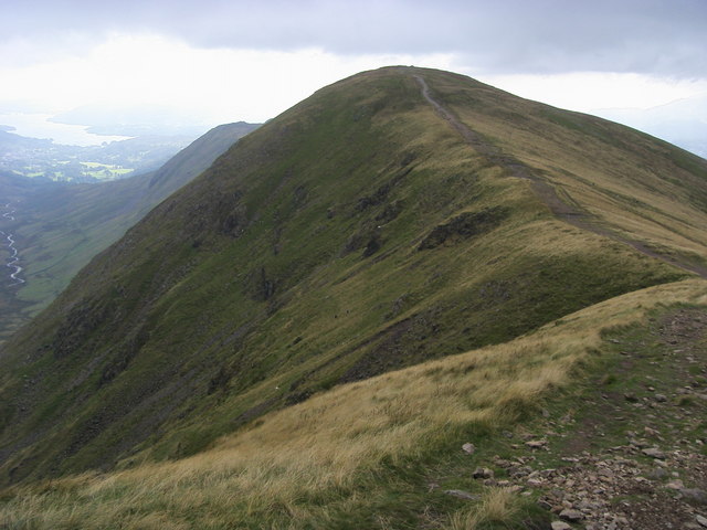
Cairn on Nab Scar LDW-193  © Shaun Ferguson under ccl Geograph
Our day started by checking out of the Keswick Country House Hotel to drive to the roadside Pay and Display Car park between Grasmere and Rydal Water (£6.50 all day).  A better option for parking (free) would have been at NY 347064 but we only noticed this roadside parking spot once we were walking.  On a day like today the spaces here were still vacant 10.30am.  

The weather was dry when we set out at 10.15am and we eventually found our way on to the bridleway (not as map) that runs west-east below Nab Scar.  This brought us out north of Rydal Mount and we set off up the rocky path to Nab Scar LDW-193.  Within a short time the weather turned evil. Wet and windy with several walkers quite wisely, especially those with children,  turning back. We continued on and reached the summit of Nab Scar at 11.55am.  We didn't linger on any of the summits - it was dangerous and uncomfortable to stand around in the unpredictable gusts and thrashing rain.  Three stations were quickly logged, Sue G1OHH, Steve M0SHM and Jordan M3TMX before we continued higher up the ridge in minimal visibility to  the featureless Heron Pike LDW-128.  
The featurless Heron Pike on a better day © Tom Richardson under ccl Geograph
On this summit I found myself in a virtual tempest and as Judy cowered behind some rocks I managed one quick contact with Sue G1OHH before continuing up to our highest point of the day - Great Rigg LDW-054.  It was now becoming dangerous with the drops down to Stone Cove on our right hand side, not seen thankfully due to the limited visibility, but the extreme steepness of the cliffs could be seen on the contour map.  Judy bagged the peak and promptly retreated back to the safety of the path junction to Stone Arthur 400m behind, leaving me activating the radio in the worst conditions I have ever experienced. on a summit.  There was no shelter whatsoever from the onslaught of the foul  weather and so it was impossible to eat , take a photo or even answer the call of nature in such extreme conditions.  The extra height gave me a much better take off though, and seven stations were logged from Great Rigg in five minutes.
The exposed path taken to Great Rigg LDW-054 on a better day © Shaun Ferguson ccl Geograph


At 1.55pm I met up with Judy again at the path junction and we started to make our way down to Stone Arthur LDW-175 which was gained at 2.35pm.  This distinctive summit as seen from Grasmere has rock cover and this allowed us the luxury of shelter to snatch a quick energy biscuit and drink. At the lower height only three contacts were completed with Dave G6LKB, Clifford M6LB and Sue G1OHH who had of course been with us steadfastly all day, thank you Sue. 

The geology of Stone Arthur shown here provided shelter © Tom Richardson ccl Geograph
A now uneventful walk took us back into the Grasmere Car Park,  just so we could use the toilets and then we took a walk back via the woodland footpaths to the car to avoid the busy A591. As this was the last day of a long weekend we then changed into dry clothes - no clothing would have kept the driving rain out on a day like we had. At 4.30pm we tucked into our packed lunches before driving back to North Yorkshire after a day spent in bedlam!
Profile of our climb to Nab Scar, Heron Pike, Great Rigg and Stone Arthur

Saturday, 24 October 2009

Walk 12

39. High Rigg LDW-210 1171'
(Then car assisted to Parkgate Farm)
40. Gowbarrow Fell LDW-181 1578'

Phil walked 3.5 miles with 1310 ft of ascent
(Vehicle used to get between Youth Centre St John's in the Vale CP to Parkgate CP Near Dockray)

Saturday and the second day of our long weekend in Keswick. It was pouring rain and with Sunday forecast to be the better day Judy decided she would join me for a longer walk then and go into Keswick to look around the shops and visit Bryson's Cafe on the Saturday. I decided to study the map and came up with a plan to do two "easy" Wainwrights near to the town.  These were High Rigg LDW-210 and Gowbarrow Fell LDW-181. They were a good distance apart so the car was used in between and I climbed the fells and returned back to the car by a similar route each time. This was going to be quick and easy and if I got wet through there wasn't a problem of suffering all day in wet clothing, which actually happened the following day when we went further south!
For High Rigg I parked at the Youth Centre in St John's in the Vale (gated road) and it took 12 minutes to reach the well screened summit.  The rain relented while I set up the VX-170 and several CQ calls produced nothing until M0WCR Mark from near Workington responded to make my walk up to High Rigg worthwhile with a qualified activation.  This was a close run thing and if there is one summit you are likely to fail on using 2m FM for WOTA then this is probably it. So the summit was qualified for WOTA but sadly not for SOTA (LD-044) as four contacts are necessary for that scheme. After another 15 minutes of fruitless calling I gave up and returned to the car having spent 30 minutes on the summit.
 

Gowbarrow Fell was my next target before I went back to Keswick for some lunch. I drove south of Dockray and parked up near to Parkgate Farm (free) NY 397211. On my way there with the rain pouring down and the lanes flooded around Matterdale End a VW Golf had come to grief and was resting on top of a dry stone wall.  It appeared that as the car had gone downhill that the driver had not made the corner and had slid off the road on wet leaves. I stopped to check because the accident looked recent.  The interior light was on in the car but there was no one about, so I continued on my way. The vehicle was still there after the activation when I returned 90 minutes later, still with no one about and the interior light turned on.  This must be a nasty piece of road as the last time I had used it the previous March a van had also left the road near to the Parkgate Farm Car park. 
I was parked and walking by 11.00am and decided to be brave by throwing my rucksack across the waterfall at 400211 despite there being a fair amount of water coming down it.  I followed my rucksack and made a good landing on the smoothe rocks - no problem as I continued on my way to the top of LDW-181, which was reached in 30 minutes.  This summit was higher by 400' and less screened to Penrith than High Rigg with Geoff G4WHA and John G0TDM quickly logged,  followed by G1OHH Sue in Lancaster. This contact provided a pleasant surprise with the signals passing straight over the top of the much higher Place Fell and Cauldale Moor (Stony Cove Pike). 
Job done I succesfully negotiated the waterfall once more and was back at my car 90 minutes after leaving it, with another summit activation completed in the Eastern Fells.

Friday, 23 October 2009

Walk 11

34. Hart Side LDW-061 2480'
35. Stybarrow Dodd LDW-021 2766'
36. Watson's Dodd LDW-041 2589'
37. Great Dodd LDW-019 2812'
38. Clough Head LDW-074 2382'

Phil & Judy walked 11.6 miles with 2780 ft ascent

This was the first and only dry day on a long weekend when Judy (XYL) and I stayed in Keswick. When we both travel over the Lakes I can't get away with leaving at 6.00am when Judy comes along. We get up later and leave home later but on this day we did quite well and were leaving the car at High Row near Dockray just before 10.30am. 

Good parking place at High Row NY 379219
We took the straight field path south west of Crookwath to Dowthwaitehead - a place without parking. As you walk this straight path through several small fields you see what is to come right before your very eyes - and today was clear enough, just about, at least to see it  - the "Dodds" which consisted of Hartside, Stybarrow Dodd, Watson's Dodd, Great Dodd and Clough Head which is thought of as the northern outpost of the Helvellyn range.  All the summits fall between 2300 and 2800ft. 

Cairn and plaque on Birkett Fell
Once we found the path which runs south of Watermillock Common we were fine and at 320193 we turned to head north west along a dry stone wall up to Birkett Fell (not WOTA) on our way to Hartside LDW-061.  On our way there we encountered two walkers from the north east who immediately noticed my antenna and said "We saw a bloke like you a couple of years ago on The Cheviot". The activator was described and there was no doubting this was my very good friend John Earnshaw G4YSS from Scarborough. It's a small world.... As we reached the 2000 ft level the mist starting rolling in and that was it until we were on our way down from Clough Head in late afternoon. Such is fellwalking in Lakeland.  At least the mist doesn't prevent signals being radiated to the avid Chaser sat at home waiting for a contact with the Wainwrights. We reach the top of Hartside at just after midday after a walk of 3.2 miles to complete just three contacts with G4WHA/M, Geoff Penrith, GM0TDM/P (John taking a holiday) and Keith G0EMM in Workington.  It wasn't pleasant and we were getting damp stood around so we moved off with guidance from my GPS, in the direction of Stybarrow Dodd. We skirted the side of White Stones. I was told that the view from here down into Middle Tongue was worth a look - sadly not today. Couldn't see a thing. due to clag.  
Stybarrow Dodd was a little higher than Hart Side though and we made 8 contacts to prove it - including one with a Norwegian station on 2m FM. Fantastic! This was Halvard LA1DNA/P operating from 3 miles away on LDW-210 High Rigg!
  
Calfhow Pike

That was a much more valuable contact than one with Norway as I gained a summit to summit contact and a vital Chaser point for a summit that is extremely hard to work from anywhere else!  Just after that I worked Mads M/LA1TPA/P who was in Keswick. The guys were in the UK to attend the QRP Convention in Rochdale and were sampling the Lake District before they journeyed on to the industrial heartlands of the north. 


The footpaths were wide and stony all the way across to Clough Head via Great Dodd and we visited the intriguing Calfhow Pike which stands well, being most prominent, at more than 2100' ASL but is not listed by Wainwright as a counter, being eclipsed by the higher summits of Clough Head and Great Dodd. Calfhow Pike certainly has its own distinctive character and this picture taken close in does not do it justice. 
We had our lunch in this shelter on Great Dodd LDW-019
Our last Summit was Clough Head - the northern outpost of the Helvellyn Masif and another grass topped hill with scattered stones around the place.  This is one summit that always catches the eye when one is heading to Keswick on the left side of the A66 near to Threlkeld.

Judy - seeing the mist clearing on LDW-026 Clough Head
Muriel Bridge on the Old Coach Road
Only four contacts were completed from Clough Head and without our Norwegian friends it would only have been two. Thank's to Mads and Halvard again for making our day and also to John G0TDM and Geoff G4WHA for being there when we needed them and spotting us on the WOTA Website.

We now had a 3.5 mile walk back to High Row and we took off to scamble over White Pike and we joined the Old Coach Road at 348229.  We crossed Muriel Bridge and found this was an enjoyable steady walk to our car in clear conditions with the road taking us back consistently at around the 1300' - 1400' level to High Row, which was reached just short of 5.30pm.  No grumbles from Judy - an excellent walk, enjoyed by both and great activating with 29 stations in my logbook. 

The next day was not good weather wise and Sunday was even worse, once again an optimistic weather forecast cost us dearly.....read on and 73 for now....

Route profile of the Five Wainwrights around Matterdale