Sunday, 25 October 2009


Walk 13

41. Nab Scar LDW-193 (1476')
42. Heron Pike LDW-128 (2008')
43. Great Rigg LDW-054 (2513')
44. Stone Arthur LDW-175 (1640')

Phil & Judy walked 9.4 miles with 3080 ft ascent

 
Our final day of this long weekend in Keswick and once again we put our faith in several weather forecasts including the MWIS and the BBC. They predicted that we would have some showers and winds of up to 25 mph. So we went for it and ended up regretting it big style, but by then we were too advanced on the ridge path between Nab Scar and Heron Pike to turn back.
Cairn on Nab Scar LDW-193  © Shaun Ferguson under ccl Geograph
Our day started by checking out of the Keswick Country House Hotel to drive to the roadside Pay and Display Car park between Grasmere and Rydal Water (£6.50 all day).  A better option for parking (free) would have been at NY 347064 but we only noticed this roadside parking spot once we were walking.  On a day like today the spaces here were still vacant 10.30am.  

The weather was dry when we set out at 10.15am and we eventually found our way on to the bridleway (not as map) that runs west-east below Nab Scar.  This brought us out north of Rydal Mount and we set off up the rocky path to Nab Scar LDW-193.  Within a short time the weather turned evil. Wet and windy with several walkers quite wisely, especially those with children,  turning back. We continued on and reached the summit of Nab Scar at 11.55am.  We didn't linger on any of the summits - it was dangerous and uncomfortable to stand around in the unpredictable gusts and thrashing rain.  Three stations were quickly logged, Sue G1OHH, Steve M0SHM and Jordan M3TMX before we continued higher up the ridge in minimal visibility to  the featureless Heron Pike LDW-128.  
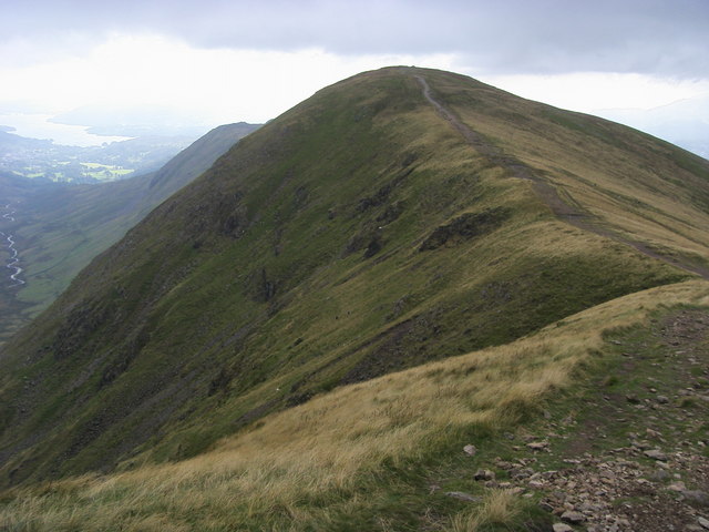
The featurless Heron Pike on a better day © Tom Richardson under ccl Geograph
On this summit I found myself in a virtual tempest and as Judy cowered behind some rocks I managed one quick contact with Sue G1OHH before continuing up to our highest point of the day - Great Rigg LDW-054.  It was now becoming dangerous with the drops down to Stone Cove on our right hand side, not seen thankfully due to the limited visibility, but the extreme steepness of the cliffs could be seen on the contour map.  Judy bagged the peak and promptly retreated back to the safety of the path junction to Stone Arthur 400m behind, leaving me activating the radio in the worst conditions I have ever experienced. on a summit.  There was no shelter whatsoever from the onslaught of the foul  weather and so it was impossible to eat , take a photo or even answer the call of nature in such extreme conditions.  The extra height gave me a much better take off though, and seven stations were logged from Great Rigg in five minutes.
The exposed path taken to Great Rigg LDW-054 on a better day © Shaun Ferguson ccl Geograph


At 1.55pm I met up with Judy again at the path junction and we started to make our way down to Stone Arthur LDW-175 which was gained at 2.35pm.  This distinctive summit as seen from Grasmere has rock cover and this allowed us the luxury of shelter to snatch a quick energy biscuit and drink. At the lower height only three contacts were completed with Dave G6LKB, Clifford M6LB and Sue G1OHH who had of course been with us steadfastly all day, thank you Sue. 

The geology of Stone Arthur shown here provided shelter © Tom Richardson ccl Geograph
A now uneventful walk took us back into the Grasmere Car Park,  just so we could use the toilets and then we took a walk back via the woodland footpaths to the car to avoid the busy A591. As this was the last day of a long weekend we then changed into dry clothes - no clothing would have kept the driving rain out on a day like we had. At 4.30pm we tucked into our packed lunches before driving back to North Yorkshire after a day spent in bedlam!
Profile of our climb to Nab Scar, Heron Pike, Great Rigg and Stone Arthur

No comments:

Post a Comment