Monday 31 December 2012


My Wainwright Blog

I started operating portable amateur radio equipment from the tops of Wainwright's Lake District Fells in March 2009. This Blog covers the days spent walking and operating from Summits.  I completed climbing all 214 Wainwright Fells in July 2011 having made amateur radio contacts from them all with a 2 metre VHF handheld radio and vertical "rucksack special" antenna.  In total I completed 1882 contacts from the 214 Wainwrights and have continued climbing and activating them since whenever I can. In early 2012 I climbed and activated all AW's 116 Outlying Fells for Wainwrights On The Air

Celebrating climbing my final Wainwright Fell on Rossett Pike - July 2012
My blog provides a constructive description and route map of all the routes taken, the distances walked, and the amount of ascent on each walk. This I hope will assist future activators and fell walkers. I have also detailed parking places, hostelries and tea shops visited and details of the friends and family that I have walked with. These include my wife Judy, terrier dog Treacle and friends Geoff Fielding (M0PYG), Nick Langmead (G4OOE) and Geoff Harper (G4WHA).  I have on occasion climbed and activated summits whilst leading walks with my walking club Ryedale Walking Group and thank those members for their forbearance!
Most importantly I also want to thank the originator of the Wainwrights On The Air  scheme the late Julian Moss (G4ILO SK) who lives in Cockermouth.
If you wish to view my photos in a larger window then you need to click on the photo and this to open up a slideshow of the pictures on that specific days blog.  Also of you click on any of the 214 fells listed on the right margin of the blog it will take take you to the specific day when that fell was bagged. 
If you are interested in Wainwright's Coast to Coast Walk see my other blog or if you are just interested in what else I have doing apart from Wainwright's see my Catterblog

Best wishes
Phil

Sunday 8 January 2012

Bannisdale Horseshoe 8th January 2012

Here we go again....with the 214 fells completed the WOTA management team had decided to add another 116 of Wainwright's Outlying Fells to Wainwrights On The Air, and I was part of that decision....
I don't intend blogging the walks I undertake in pursuit of these 116 Outlying Fells - most are unspectacular, but just a few, such as Black Combe and the Dunnerdale Horseshoe circuit are. So I'll see how enthusiastic I am about writing about them as I go on. As this walk was the first in a series of Outlying Fells walks, I feel I ought to blog it as a marker. 

I met up with my friend Geoff at Dryhowe Bridge - shortening Wainwright's original Route OF56 from Book 8 by over two miles. That made our walk in the mist for the most part, just short of 9 miles with around 2000' of ascent, here is my GPS track of what was actually walked:
We left Dryhowe Bridge and could see we would soon be in mist. Whiteside Pike was clear but from Todd Fell on we were in mist with visability down to around 50m at best for the rest of the horseshoe until we came down off Lamb Pasture. Near the top of Whiteside Pike by the wall at 1200 feet, the resourceful farmer from Dryhowe Farm 500 feet down in the valley, had erected this TV and radio aerial to improve his reception. He must have had a good preamp - the antenna is 1 Km away from the farm!
The farmers remote TV aerial near Whiteside Pike - the hill in the background is LDO-016 The Forest
Whiteside Pike LDO-050 was the only well defined summit from the nine visited today, stations worked: M6UXH M5TNT G1OHH M3RNO/M and G0TDM. 
Whiteside Pike LDO-050 activation - Todd Fell LDO-048 behind
We headed north covering the ill defined summits of Todd Fell, Capplebarrow, Swinkelebank Crag, Ancrow Brow, Long Crag (lunchtime stop),  White Howe, The Forest and Lamb Pasture. We were thankful of GPS not only for route finding in the mist but for sure placement of the summits, which in many cases were defined by just a few stones! These had been pre-programmed into the Garmin Vista.  We left Lamb Pasture at 1415z and were back at our cars at Dryhowe Bridge at 1430z. Yes, these Outlying Fell walks are much easier than the bigger fells from Books One to Seven. Nine summits activated in a 5.5 hour walk. 
Walk profile from G4OBK GPS - The Bannisdale Horseshoe
There was a plethora of contacts to be had on this round with 59 QSOs being completed, including a summit to summit contact with Rob G4RQJ/P on Little Mell Fell. G1OHH Sue in Lancaster was the only station to make contact on all nine summits, and the best DX was a contact with MW0TTK Mark near Mold in North Wales when activating The Forest LDO-016.  This was not the most enjoyable walks on account of the mist, but we had bagged nine summits so shouldn't complain. Tomorrow we planned to tackle the Naddle Horseshoe walk which is further north and favoured the stations in Penrith and points north of Shap. 

Saturday 24 December 2011

10 Wainwrights around Grisedale 22nd December 2011


Profile of my route above Grisedale on 22nd December 2011
I set out on my solo walk  from the Patterdale lay-by just past the White Lion in the dark at 7.30am - excellent public toilets there, clean, working hand dryers and well lit with toilet paper on tap....well done Eden District Council. 

My plan was to cover the ten Wainwrights in the Eastern Fells which surround Grisedale and I expected to be back at the car by 5.30pm.  My main interest having done all these summits before was to accrue 44 points for SOTA on my push for the Mountain Goat Award - I started SOTA in 2005 and still have a long way to go.  I also wanted to give WOTA Chasers a few new Wainwright's. This scoring tally includes 12 winter bonus points for qualifying the summits of Helvellyn, Seat Sandal, Fairfield and St Sunday Crag.  This round has been done before in the winter on HF by John G4YSS, using the callsign GX0OOO but no one has ever added six Wainwrights to the walk. I needed to be swift as I could be during the activations needing every minute of daylight.  I was carrying my Yaesu VX-170 (X2) Transceivers and one spare battery pack. The antenna was the usual J Pole rucksack special. 

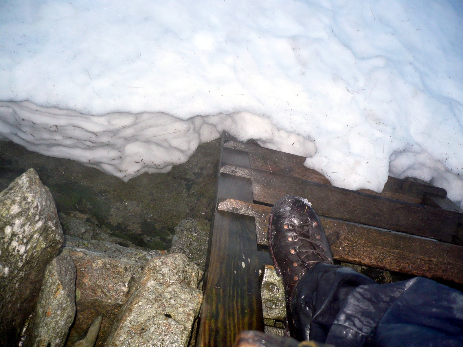
Snow drift - ladder stile at Hole in the Wall
The weather was mild but damp in Patterdale (12c) when I set out with showers expected. A poor forecast for the fells had been given as it transpired - it was wet windy and misty almost all day. I reached the Hole in the Wall at 0850z having encountered the first snow patches in hollows at the 1500ft level. From here I climbed the ladder stile to head up to the activation zone for the ill defined summit of Birkhouse Moor (LDW-078) and called CQ.  Only three of the "regulars" were worked - John G0TDM, Geoff G4WHA/A and Mark MM1MPB.  John and Geoff were to work me on all ten summits, Mark missed out on one due to a doctors appointment! A five minute stop and I set off back to the stile and onward via a wayward path to Catstycam LDW-010. I went wide to avoid snow drift and finished up heading for Striding Edge, visibility was down to about 25m and I never saw Red Tarn. Veering back to Catstycam I crossed Red Tarn Beck which is the outflow from Red Tarn and it was deep today.  I didn't quite top my boots.  Turning right before Swirral Edge I was soon on the summit of Catstycam -  a mini Matterhorn and one of my favourite Wainwrights, arrival time 1000z.  My first contact was summit to summit with John G4YSS/P who was using the Scarborough Special Events group callsign of GX0OOO/P from North Pennines-001, Cross Fell with 59 reports both ways.  Another nine contacts were completed including one with David G6ENN/P who was on a walk around Derwentwater whilst on his holidays. 

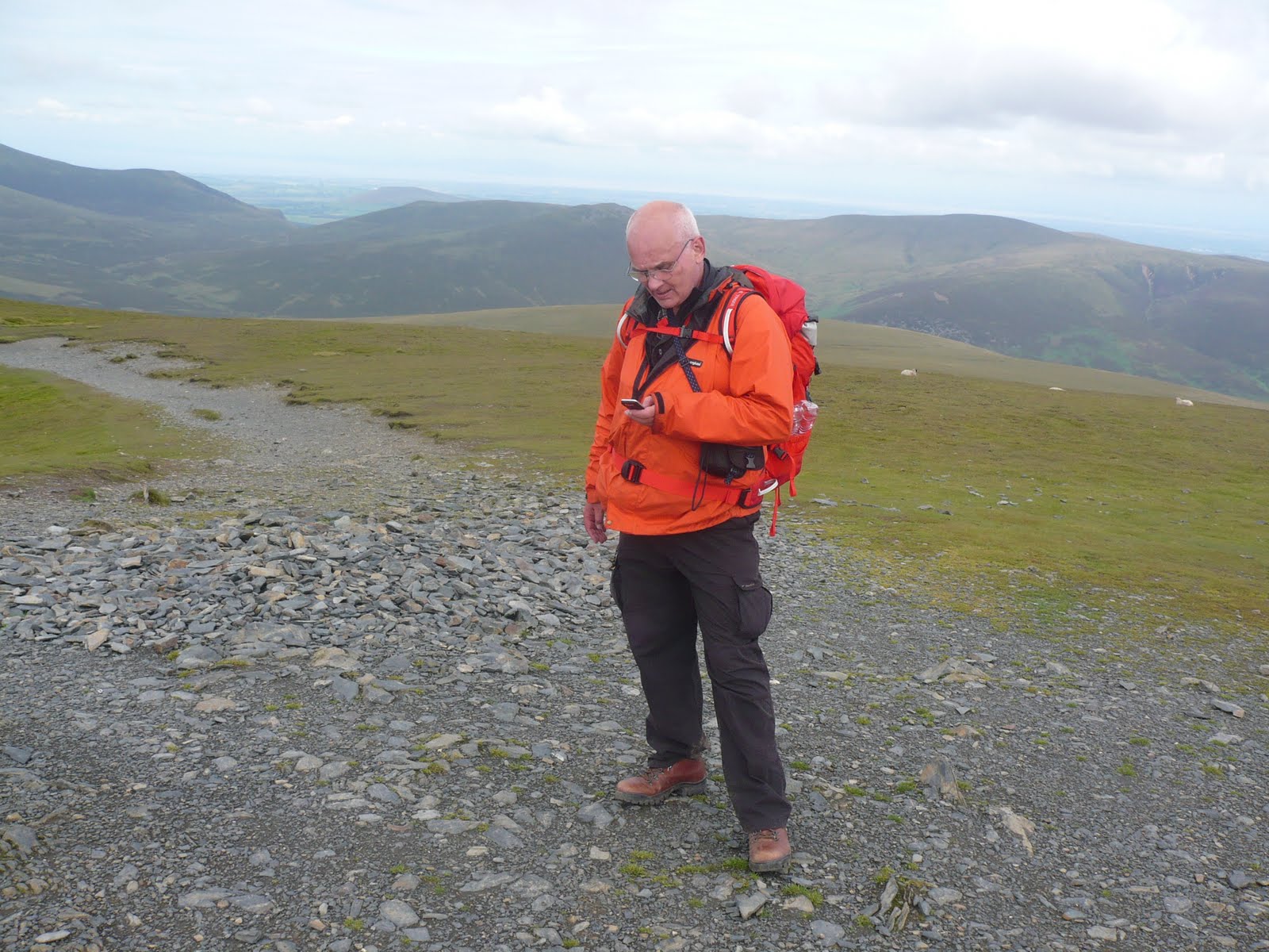
My pack on the day G4OBK/P

Tackling Swirral edge was straightforward and quite safe up until the final section. Strong winds had melted the snow off the top of the ridge so that was my chosen way, rather than using the snow bound paths that run up both sides. It wasn't icy - I guess the temperature was around 4c by then but there was a lot of water around and the rock was slape. I knew that this time last year two walkers fell off Swirral and both incidents were fatal, so extreme care was needed.  I took my time thinking carefully about every step taken.  By the time I reached the final snowbound slope at the top I had lost time on my schedule but I was safe. At this point I carried my ice axe but the snow had an insufficient crust for it to be much use, however I felt more secure with it in my hand as I climbed the last 50m or so on to the shaley summit of Helvellyn.  The whole climb of Swirral took me 20 minutes and I was safe on top on LD-003/LDW-003.  The best QSO for me from here was with Tim G4YTD/P who had just arrived on High Street LD-011. I worked Tim on 2m FM as he was setting up for 80m. Tim reported 66 mph gales on High Street and yes, the wind was strong but I felt it to be about 40 mph on Helvellyn and I was not in any risk of being blown off my feet as happened to me earlier in the year on Kirk Fell. It never fails to amaze me that the mist stays put despite gale force winds on the top of mountains. 

Cornicing near Nethermost Pike LDW-009
The shelter was snowbound apart from one corner which was in the wind, but I sat down to make 15 contacts in 10 minutes. As I was packing up I chatted to one well equipped walker who had come over Striding Edge remarking that it was passable with care. He was proceeding back via the pony track towards the Glenridding Youth Hostel. 

Helvellyn itself was clear of snow almost up to the edge, but as I continued my journey on to Nethermost Pike I was shocked to see evidence of foot holes close to the edge of the cornice. Some folk must get a buzz out of putting themselves at great risk......I kept well away.  

Herdwicks at 2000 feet
It only takes 15 minutes to reach Nethermost and another short stay of ten minutes produced ten QSOs.  It took 20 minutes to reach Dollywaggon Pike and the first contact was another S2S with Glyn G1IEP/P who had just arrived on Ingleborough NP-005, Glyn was one of thirteen contacts which included John G4YSS/M who had returned to his vehicle on Great Dun Fell near the radar station gate after his activation of NP-001. It was pleasing to see that the milder weather had brought out plenty of activators in northern UK after the previous week of snow and rain. 

I now needed to descend and cross Raise Beck which is the western outflow from the Grisedale watershed. I hadn't been this way to Seat Sandal before and it turned out to be a good route. I came out of the mist at around 2000 feet to encounter a few Herdwicks and a few chances to take photos before the mist closed in on me again. I crossed Raise Beck at NY 33987 12083 and proceeded (with several rest breaks to catch my breath) to the top of Seat Sandal LD-022/LDW-069.  Just after seeing the sheep I heard Brian GW4ZRP/P call CQ from NW-044 Moel Famau.  I was Brian's first contact I believe - shame I wasn't on a summit at the time but en-route. 
Seat Sandal LDW-069 (SOTA LD-022)
I reached the summit of Seat Sandal at 1305z and stayed 30 minutes as the weather had now improved. Sitting against the broken wall I had my lunch and then made 15 QSOs finishing with an S2S contact with Mike M6MMM/P on SP-004 Shining Tor. Once again the fell top was clear of snow thanks to the wind shifting it away. 

View over Dunmail Raise when the sun came out briefly on Wythburn Head


I took my usual route off the fell down the left side of the wall, this was quite snowbound with a good melt taking place so holes could be kicked into the drifts for safety. The snag was you did not know if the snow was 3 inch deep or 3 feet and I was down to my crutch with one leg on occasion. My boots were filled and that meant wet feet for the rest of the day. I should have put my gaiters on over the top of my overtrousers, but felt this would have been too hot. You live and learn....

I left Seat Sandal at 1340z arriving at one of the shelters on Fairfield LD-007/LDW-013 at 1430z. I was now becoming tired and uncomfortably wet to the skin but at least I was not cold.  I stayed 20 minutes, sat down and made another 15 QSOs including S2S with Brian GW4ZRP/P on NW-051 Foel Fenli and with G8JSM/P on SP-017 Billing Hill (Not reported on SOTAWatch).

I had relied on telephoning Roy G4SSH just prior to arriving on all four SOTAs and it really paid off with chasers queuing up to work me as soon as I keyed up, saving me vital time. I was now more than one hour overdue on my predicted schedule and I was to fall back further on my return back to Patterdale via Cofa Pike, St Sunday Crag and the last two Wainwrights of Birks and Arnison Crag.  I still had daylight as I scrambled carefully down Cofa Pike.  With snow in evidence and now tender knees to consider I was looking forward to the ascent from Deepdale Hause up to St Sunday Crag LD-010, my final SOTA summit which I needed to claim the 44 points for the day on my long journey to the Mountain Goat Award.  The walk from Fairfield seemed to take forever and I was in position on LD-010 in just short of an hour.  Only eight contacts were completed and they were all regulars who had been following me around my route most of the day. Thank you all: G0TDM, MM1MPB, G6LKB, M0XSD (Colin - new callsign), M6EPW, G4WHA/A, M6AUE AND 2E0MIX.  I stayed 20 minutes and felt the cold now for the first time, moving off as quickly as I could into the gloom at 1605z to Birks LDW-125. It was dark by the time I reached the col above Blind Cove and I branched off right to Birks to see if I could locate the path, which I did in due course.  It was now pitch dark but my Petzl headlight was performing well giving me safe passage across the moor to arrive on Birks at 1638z.  Surprisingly I made 9 QSOs from this one which including Tom M1EYP/M and son Jimmy M3EYP/P on their way to Northern Ireland to activate summits there.  (I had earlier worked them both from Fairfield as they were passing Leyland on the M6.)  

Birks was now clear of mist and it was comforting to see the lights of Patterdale and Glenridding below me as I proceeded off the fell.  I left at 1650z to proceed across unknown ground to the wall at Trough Head. From there I was to follow the wall round to the base of Arnison Crag LDW-194 to finish my tenth Wainwright of the day.  This last tiddler give me a real problem with fatigue and a lack of vision outside a 10m radius now playing its part in my mission. I reached what must be the most substantial wall in Lakeland at NY 38785 14550 and for some reason felt I needed to be at the other side of it. The wall was over six feet tall at my side, solid and topped with a well supported netted fence. Hadrian would have been proud of that wall.  Why I felt I needed to be over it I do not know - now I think back I reckon my thought processes were becoming "Kaput". I went north for 200m along the wall in an effort to find a gate - nothing, so I returned to the beck which goes under the wall and crossed it, proceeding to the wall junction at NY 38807 14515.  I continued north east now and came across a cast iron metal ladder - the type of shooting platforms you sometimes see in the countryside. This had been fixed against the wall as a crossing point and I mistakenly climbed it, finishing up on the wrong side of the wall to Arnison Crag where I needed to be.  The wire top on the fence was intermittent and eventually as I started to lose height I found some well placed through stones on which to climb over the wall. "Hadrians Wall" must have been 7' at that point but around 5' at the other side. I fed my sac and pole on to the top of the wall and climbed it and then made my way (or so I thought) up to the top of Arnison Crag.  After a bit of a wander I found the summit and the lights of Patterdale below me. I got a result - three QSOs with the regulars, G0TDM, G4WHA and enough to qualify and give Mark MM1MPB his 202nd Wainwright putting him in 3rd place  ahead of John G0TDM in the WOTA Chasers table.  I left the fell in the right direction but then lost my orientation completely and headed in the direction of The Kirkstone Pass Inn. After wandering around the fell top for 5 minutes or so in the dark I found the right heading at 1810z reaching the car in Patterdale at 1854z.

Vital statistics

14.8 miles walked

6075 feet climbed

Walking time: 8 hours 50 minutes

Summit stopped time: 2 hours 35 minutes

Yaesu VX-170 1st battery used for 98 QSOs

Yaesu VX-170 2nd battery used for 3 QSOs

102 Contacts (101 from summits 1 en-route with GW4ZRP/P on NW-044)

28 different stations worked

G0TDM & G4WHA worked on all 10 summits

44 points claimed over 4 summits for SOTA

6 Summit to Summit contacts

1 Summit Chaser Contact with GW4ZRP/P on NW-051 whilst walking

10 Wainwrights activated (Zero points as had previously activated)

Left home 5.00am returned home 10.00pm with 228 miles driven


Friday 22 July 2011

Walk 58
9.4m / 3350' ascent
Phil G4OBK, Nick G4OOE & friend Geoff
Time Taken 8 hrs 23 mins

212. LDW-006 Bow Fell
213. LDW-011 Esk Pike
214. LDW-115 Rossett Pike

The route taken by Phil G4OBK, Nick G4OOE and friend Geoff on 22nd July 2011
This was the day I completed my last three Wainwright summits from the 214 fells listed in the great man's seven pictorial guides. 
It had been a good dry previous day on Blencathra I reflected, when we awoke to a showery day at our Bed and Breakfast Robinson Place Farm in Great Langdale.  After a good feed we were ready to start walking from the nearby Old Dungeon Ghyll Car NT Car Park at 9:20am. 
Our route can be found in the large format book "Walking with Wainwright" but I only realised that when Nick G4OOE told me about it when we returned home. I have that book (pictured right).
The route leaves the car park and follows a flat tarmac farm road to Stool End, from which we passed through a farm gate to start the climb up The Band, the actual path deviating somewhat from the public right of way shown on the OS map, nothing unusual in that in these parts! There was Geoff ahead, myself taking my time and Nick G4OOE bringing up the rear, all members of the Wainwright Society and Nick and I keen radio amateurs and WOTA activators. This really was a special day for me and the sun soon came out to celebrate allowing us to pack away our rain jackets for the climb on to Bow Fell.
  
The fingerpost points the way from Old Dungeon Ghyll Car Park
After walking 1 Km or so I called on S20 to see if Geoff G4WHA (who was with Mark M1MPB) had arrived in Langdale yet, and they had. They were just leaving the New Dungeon Ghyll Car Park on their way up to Pavey Ark.  Geoff was hoping for a QSO with me when I arrived on my final summit of Rossett Pike LDW-115.  Providing Geoff had a contact with Colin G4UXH who was expected to arrive on Black Fell LDW-212 long before I got to Rossett Pike this would be Geoff's last Wainwright as a Chaser - which would mean that he was the first ham radio operator to make contact with every single Wainwright summit via radio.  Doing a high level walk on the same day as this walk guaranteed success.  Contact back to Geoff's home in Annan may have proved difficult as the signals would need to pass through Glaramara and the High Spy Ridge to reach Annan - an unlikely prospect! 

This is Nick G4OOE the previous day on Blencathra LDW-014
I got slightly ahead of Nick on what was a steady walk up to the Three Tarns where we had a short break before we all proceeded together to the summit of the 2959' Bow Fell - LDW-006.  We were on the air before midday and the first contacts made were summit to summit with Geoff G4WHA and Mark M1MPB across the valley on Pavey Ark LDW-089.  Our next contact was with Colin G4UXH on Black Fell who had just provided G4WHA with his 213th Wainwright as a Chaser.  The best DX was to Alan M1EYO/P on SB-005 Sighty Crag and it was a pleasant surprise to hear Terry G0VWP/P come back, not from his home town of York but from TW-004 Bishop Wilton Wold in East Yorkshire, a good distance on 2m FM with 5 watts and a vertical antenna. Terry's directional beam obviously making all the difference and ensuring we made contact.  Brian G4ZRP who is on The Wirral called in and completed the contact with perfect readability using a minimal 20 milliwatts. Mike G4BLH was the last of our 17 contacts before we moved off the short distance to Esk Pike (35 mins).
  
Activating Esk Pike LDW-011 for WOTA
On arrival at Esk Pike it was lunchtime so we set up camp for the best part of an hour.  In between taking in  the views, eating and chatting to the occasional fellwalker we each made 22 contacts with more S2S QSOs with the stations previously mentioned, although Geoff and Mark were of course now on different summits giving Nick and I valuable bonus chaser points from my 213th Wainwright fell of Esk Pike. 
So it was on to my last unique Wainwright, Rossett Pike LDW-115. A summit which had never been activated on amateur radio for WOTA. Somehow the summit had passed under the radar of other activators. I'm not sure why as AW devoted 8 pages to the summit in Book Four, The Southern Fells.  We walked down towards Esk Hause, cutting off the corner off as the going was good,  before doubling back down the valley to Angle Tarn, with Rossett Pike prominent in front of us.

Phil G4OBK and friend Geoff reaching the top of Rossett Pike (Photo:G4OOE)
Nick G4OOE stayed back to capture this picture of us reaching the summit of my 214th Wainwright for our hour long stay, so we waited for Nick before we cracked open the champagne, it was the least we could do!  

Cheers! A celebration on Rossett Pike
It made my day when I called CQ and Geoff G4WHA who was now on the summit of Thunacar Knott LDW-076 came back. Not only was this my 214th Wainwright activator point, it was also Geoff's 214th chaser point. I worked Mark M1MPB who was with Geoff also on LDW-076.  Nick G4OOE took the radio to make his contacts and that left my hands free to crack upen the champagne. The sound of the cork popping was broadcast and was heard across the airwaves, so the happy moment was shared.  Colin G4UXH was still occupying Black Fell LDW-212 to hear it and complete another S2S contact.  We then worked 2E0VCO on Hutton Roof Crags LD-052 and M1EYO who had left the Scottish Borders and arrived on LDW-173 Little Mell Fell.  The final S2S contact was across to Harrison Stickle LDW-068 when G4WHA and M1MPB arrived there prior to us leaving Rossett PIke.  The champagne went down well, only a half bottle was carried so we managed just one glass each.  We finished with 15 contacts on my final Wainwright to bring our total contacts for the day to 54 QSOs each.
The walk back down Mickleden returned us to the Old Dungeon Ghyll where we decided to return to later for our meal, the menu appearing more varied that at the New Dungeon Ghyll where we ate the previous night. However, this was the place where we planned to meet Geoff G4WHA and Mark MM1MPB, so we jumped into the car and drove the short distance back to the NDG.  This is what we drank:

Two pints of Wainwright landlord.....
So how did it feel, now I had finished - no different at the time but it left me wondering now what I can do next apart from revisiting some of the 214 fells which were visited in bad weather, or the ones which I enjoyed the most and wanted to do again.  As I write this report two weeks on I am still reflecting on my experiences and I am wanting to return to the district whenever I can afford to, hopefully to climb and activate from Wainwright's Outlying Fells where it should be possible to pick up some more chaser points from the 214.
It has been an expensive business climbing all the Wainwrights, but the expense has been much reduced thankfully by my wife Judy who also enjoys fellwalking sharing the costs (but not all of the extreme fellwalking in bad weather!) and my friend Geoff who has gone halves on travelling expenses and sharing accommodation costs.  So here are a few statistics from my 28 months spent climbing all 214 Wainwrights, all recorded on GPS:

Date Started:  23rd March 2009  (WOTA Scheme by G4ILO commenced on 21st March 2009)
Date finished all 214 Fells: 22nd July 2011
Number of walk days: 58 
Distance walked (Measured by GPS): 499.85 miles
Total ascent: 165,515 feet
Average number of unique summits per walk day: 3.7
Average distance walked per day: 8.6 miles
Average ascent per day: 2850 feet
Number of WOTA activator contacts I made over period: 1882 
Toughest Walk: Kirk Fell/Pillar/Scoat Fell/Steeple/Red Pike (Wasdale)/Yewbarrow: 10m 5250' ascent
Easiest Walk: Little Mell Fell: 0.7 mile 400' ascent 

It was difficult for me to reach a decision on which was the toughest walk, but taking into account the severe weather conditions experienced in Wasdale on 1st April 2011 the walk above is what I decided was the toughest of the lot. We started our walk from Burnthwaite in Wasdale at 9.32am on that day and we finished it at Overbeck Bridge, Wasdale at 7.42pm.  During the walk I fell and suffered a knee injury which took five months to heal, but thankfully this was not sore enough to stop me walking.

Anyway, back to New Dungeon Ghyll and after chatting on and off on 2m FM for most of the day the gang met up:

Geoff, Phil (G4OBK), Geoff (GM4WHA) Mark (MM1MPB) thanks to Nick G4OOE who took the picture
It was around 7.30pm when we split, the three of us heading back to the ODG for that better menu and to discuss our plans for our last day when we decided to visit Muncaster Fell, Black Combe and Kirkby Moor for SOTA before heading home.  

Our best meal of the trip - Barnsley Chop with real chips at the ODG

Thursday 21 July 2011

Walk 57
11.1m / 3160' ascent
Phil G4OBK, Nick G4OOE & friend Geoff
Time Taken 7.5 Hours

208. LDW-014 Blencathra
209. LDW-121 Mungrisdale Common
210. LDW-087 Bowscale Fell
211. LDW-096 Bannerdale Crags

Route taken on 21st July 2011 from A66 Car Parking at Scales
It was day one of a short break to finish off the 214 Wainwrights a project which had taken me over two years since I started with my first climb on LIttle Mell Fell on 23 March 2009 .  Once complete, the next day, I would be the first radio amateur to have ham radio contacts from the summit of all AWs 214 fells. On this trip I drove over early morning to Scales near Penrith with Nick G4OOE a fellwalking friend, who lives in Scarborough.  We met our friend Geoff who had driven up from Malvern, in the lay-by alongside the A66 at Scales and were walking by 9.30am.  

After one mile Nick took off on the well hewn path over Scales Fell and Geoff and I continued towards our first ascent of Sharp Edge which we could clearly see ahead of us. None of us had ever climbed Blencathra, the second highest of the Northern Fells group after Skiddaw,  before. The weather was fine, cloudy but dry with little wind, and this boosted our confidence.  At 10.45am we were at the foot of Sharp Edge.  From there to the top took Geoff and I just 15 minutes. We could pick out Nick in his red jacket ascending the ridge on Scales Fell as we went across. All three of us arrived at the top within a minute or so of each other.


Geoff starts his ascent of Sharp Edge
Geoff completes his ascent of Sharp Edge
The activation for WOTA/SOTA was underway almost immediately on the 8 point SOTA summit and Nick and I made 20 contacts each on 2m FM, the best ones being summit to summit QSOs with Terry G0VWP on Bishop Wilton Wold (Garrowby Hill), Frank GI3RMD in Northern Ireland on Slieve Donard, and Derek 2E0MIX on Great Gable.
  
Geoff - Nick - Phil - the three of us reunited on the top of Blencathra
We picked out what we determined to be the actual summit - a stone ring embedded in the ground and placed there by the Ordnance Survey. presumably in lieu of a Triangulation Pillar which was absent:
Ordnance Survey stone ring on Blencathra
Whilst packing up our gear Arthur and LInda Jenkinson came over for a chat. They were aware of what we were doing as they are good friends of Colin G4UXH and Heather M6UXH from Milnthorpe! It's a small world.


Keen Fellwalkers Arthur & Linda Jenkinson - friends of friends (see text)
We left the summit at 1205pm and dropped down the 235 metres to Mugrisdale Common LDW-121. This was a most disappointing "summit" and one which we all thought Wainwright chose just to fill the book alongside the 36 pages he devoted to Blencathra.  In my opinion the 6 pages AW devoted to Mungrisdale Common was over generous! We followed this with two more to the east  - the slightly higher and more summit like Bowscale Fell and finally Bannerdale Crags, from which we departed at 3.25pm, arriving back to Scales just before 5.00pm. 


The disappointing Mungrisdale Common "summit" 

We both completed 41 radio contacts over the four summits.  
From Scales we drove across the Lake District to Great Langdale to check in at our B&B for the night. We stayed over at an excellent spot called Robinson Place Farm, run by Vicky Edmundson. This  turned out to be a tenanted farm owned by the National Trust. I was so delighted with this establishment that I made an entry in Trip Advisor and said so, which I do on occasion if I am delighted or if I am dissapointed.
The next day I was to complete my round of 214 Wainwright Fells with a climb over Bow Fell, Esk Pike and finally Rossett Pike which was my last of the 214 summits listed in the pictorial guides. 


For an alternative walk I did in September 2012 up Blencathra via Hall's Fell ridge, continuing to Lonscale Fell, Skiddaw and Carlside check out this link:

Sunday 12 June 2011

Walk 56
8.5m / 4000' ascent
Time Taken 6 Hrs 45 mins

205. Lingmell 2648'
206. Scafell 3163'
207. Slight Side 2500'

Route taken by Phil G4OBK and friend Geoff on 12th June 2011
Day 3 and the last day of our Ennerdale and Wasdale tour and our chance to clear up the last few Wainwrights I needed to climb in the Southern Fells Group.  We knew that Steve M6MNT, Derek 2E0MIX, Heather M6UXH and Bob M3XJV would also be on the Lakeland Fells and it was to be interesting day ahead.  We didn't want a long day - with me having a 160 mile drive home to North Yorkshire and Geoff returning to Malvern 220 miles, we needed to be leaving Wasdale before 4.00pm.
Looking back to Wastwater from the Lingmell path

The Wasdale Head Inn below us on the climb to Lingmell
Driving the short distance from Bowderdale Farm down to the NT Car Park at Brackenclose was when we realised we were among a fleet of minibuses, realising that these were groups of walkers who were tackling the Three Peaks of Ben Nevis, Scafell Pike and Snowdon within the 24 hours allowed.  Most of them looked like university students. It was quite a melee as several groups had set up feeding stations on the NT Car Park, without paying the fee at the machine!  The NT Wardens know the score and there they were at 0830am collecting the parking tariffs directly from the drivers! We were walking soon after that and immediately went wrong by missing the path shown on the map as a dotted line forking left up to Lingmell just after the footbridge. This was the first of two mistakes made on the day.... We paid for my error this time by having to climb an extremely steep grass bank after the next stone wall to take us on to the route we wanted.  The view from this steep grass path down to Wastwater is breathtaking on the sort of day we had. 

The climb to Lingmell took a shade under 90 minutes from the car park and this took us within shouting distance of Scafell Pike which we had climbed earlier in the year. The beauty of this route was that we saw no one until we left the summit of Lingmell and popped over to Scafell Pike without stopping off  to reach Mickledore and Scafell itself, a new one for both of us. 

The writer at the cairn on Lingmell 
My activation of Lingmell produced 14 contacts on the 2m VHF band including contacts with stations on Latrigg, and The Knott. We stayed for 20 minutes, took a drink and then moved off.  
As you cross Mickledore Broad Stand looks "doable", however once get close and you stand against it you realise that without climbing equipment and the necessary ability it could not be climbed without great risk. 
The col of Mickledore seen as we approached it from Scafell Pike.
 Broad Stand is straight ahead


The path we took up to Scafell - a bad route and not recommended - continue further down the gully and look for a more defined path up to Foxes Tarn which will be  much safer than this route was
We headed south east walking against the side of Broad Stand looking for a way up to Scafell - the second highest Wainwright Fell.  MISTAKE - we would have been better continuing down the valley, losing more height before then turning back to walk up to the minute Foxes Tarn.  You could say we "half climbed" Broad Stand and went up far too early. No damage done and we our Mojo was still intact, we havn't lost it yet! 
Once it got easier towards the top of Scafell I started striding out reaching the shelter at 1208pm. Geoff had dropped back, but only because he had lost one of his contact lenses whilst scrambling over some rocks.  No chance of finding it, and I offered my apologies for going ahead. 
The activation commenced and lunch was taken. 18 contacts were completed and we moved off after a 30 minute stop down to our last one of the day Slight Side LDW-057, which is rather screened off to the north by the Scafells.  It's a 35 minute walk to Slight Side from Scafell and the weather was blowing up with drizzle starting to fall.  
Geoff less one contact lens - looking scary on Slight Side - we needed  to be well wrapped up
We stayed 20 minutes, qualified the summit with a surprising 19 contacts, the path being very good to the south and then moved off towards the land above Burnmoor Tarn.  We reached the Brackenclose car park within 100 minutes at 3.13pm to say our goodbyes and head back to our wives and our dogs. 

Saturday 11 June 2011

Walk 55
10m 3020' ascent
Time Taken 7 hours

202. LDW-153 Lank Rigg 1775'
203. LDW-094 Caw Fell 2287'
204. LDW-036 Haycock 2615'

Route taken by Phil G4OBK, Colin 2E0XSD and friend Geoff on 11th June 2011
We were very grateful the previous night when we spoke to Liz (soon to be M6EPW) and Colin (2E0XSD soon to be M0XSD) when they offered us a lift to the start of our linear walk from Ennerdale over the top and down into Wasdale, where we would spend our last night at Bowderdale Farm B&B.  Liz dropped us off at Whorl Gill NY 067130 and the three of us proceeded on what was a fine walk. 
Sellafield and the coast as seen on our walk
This part of the Lake District is less frequented than most as is the the Shap Fells, it may not be the most dramatic in terms of vista but I find this lack of people most satisfying.  We reached the summit of Lank Rigg LDW-153 in just over an hour, a trudge over moors where there was no path in evidence for the most part.  From the summit the view down into Worm Gill and the (Water) Intake Works below us and over to the Sellafield nuclear complex was quite spectacular. 
The view down below into Long Grain from Lank Rigg
We completed 9 contacts on VHF from here, including a chat to Brian G4ZRP down on the Wirral. We were quite pleased with that.  Our route took us down to the Intake Works and it was close to here that Colin found a panel which must have fallen from an aircraft. 
Colin with the aircraft panel

Leaving Lank Rigg at 1036am we reached Caw Fell at 1227pm - a two hour walk above the extensive crags of Caw Fell.  We stayed for 35 minutes and completed S2S contacts from there with M6MNT on Great Gable LDW-005 and with G4ILO who was on Binsey LDW-190. 

After moving across the ridge to activate Haycock (LDW-036 - 18 contacts completed) we turned right to head down to Wasdale with Colin later going straight on to then return back to Ennerdale where he would be collected by Liz.  By the time we reached Haycock Steve M6MNT/P was speaking from Base Brown LDW-117 and we exchanged reports. We followed this with another S2S QSO with Bob M3XJV/P on High Stile. On leaving the activation zone Colin remained on Haycock for some time eating his lunch. This enabled me to pick up a chaser point once we were far enough down from the summit. 
Three wise men on the summit of Caw Fell  LDW-094
Apart from Geoff filling his boot by going down to his thigh in a hole with one leg as we proceeded down by Little Lad Crag, the downhill walk back to Wasdale on a good path for the most part,  was quick and uneventful and we reached the Bowderdale Farm at 4.00pm. 
One of my favourite Wainwrights - Yewbarrow seen through the trees at  Netherbeck Bridge
After the poor food for the price and service at the Wasdale Head Inn earlier in the year we opted to drive to Nether Wasdale and eat at The Screes Inn. Our meals weren't bad but we felt that the meal we had in April across the road from the Screes Inn at The Strands Inn were far superior. 

Friday 10 June 2011

Walk 54a
5.3m 1210' ascent
Time Taken 2 hrs 40 mins

198. LDW-177 Grike 1601'
199. LDW-162 Crag Fell 1716'

Walk 54b
7.9m / 2900' ascent
Time Taken 4 hrs 30 mins

200. LDW-127 Great Borne 2021'
201. LDW-122 Starling Dodd 2077'

Route taken on walk 54a (morning) by Phil G4OBK and Geoff on 10th June 2011
Route taken on walk 54b (afternoon) by Phil G4OBK and Geoff on 10th June 2011
A three day tour of Ennerdale and Wasdale Part 1 - 10 June 2011

After a months rest Geoff and I returned to the Western side of the Lake District for a short break staying at the Ennerdale View B&B in Kirkland, a house we stayed at when we completed Wainwrights  Coast to Coast in 2010.  Prior to driving into Ennerdale my car had been parked in Wasdale at Bowderdale Farm and would be collected in two days time. 
The deforestation taking place below Grike


We decided to split our day into two and save some energy by using Geoff's car to reach the start of the afternoon walk north of Ennerdale Water. Our morning walk was out and back the same way to the summits of Grike (LDW-177) and Crag Fell (LDW-162).  From Blakeley Moss it took less than three hours to visit the summits and complete the activations. Derek 2E0MIX/P was out and we spoke to him on Harter Fell LDW-112. We also completed a contact with Steve M6MNT/P who was on Haystacks LDW-131. We went on to later meet Steve in the afternoon on Great Borne.
Deforestation was taking place on our route up to Grike. AW would have been pleased about that as he was against the forestation of the Lake District.  I completed 18 WOTA contacts split between Grike and Crag Fell. before we return via our outward route, not something I like to make a habit of, always preferring a circular route when possible for variety. 
After returning to Geoff's car we drove to the car park below Bowness Knott on the north side of Ennerdale Water.  


Approaching the Bowness Knott Car park
We misjudged the walk up to and over Great Borne (LDW -127) and Starling Dodd (LDW-122), the walk proved harder and longer than we thought. We set out at 2.15pm and returned to the car at 6.45pm. 


A scrap metal dealers delight - the summit of Great Borne LDW-127
(Thanks Steve M6MNT for the photo)
Unbeknown to me when I left Great Borne was that in error I had left behind my baseball cap which is emblazoned with my callsign G4OBK. On arrival on the summit of Great Borne we met Steve M6MNT, who had been activating day in day out for a week or so, whilst spending his holiday in Lake District, much to the delight of the chasers who had filled him in about what WOTA was all about when they heard him calling CQ from a summit earlier in the week. 
I have to thank Steve for collecting my cap and returning it to me the following week by post - what a fine fellow and I hope we can meet again when he is next in the Lake District. 
After the long walk back along the forestry road on the north shore of Ennerdale Water we returned to the car pretty well fagged out after a day of two walks, but at least we a had another four Wainwrights in the bag.